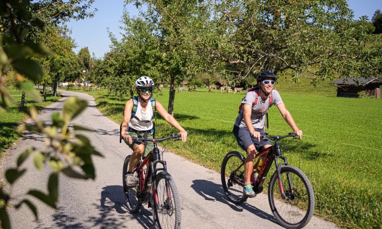
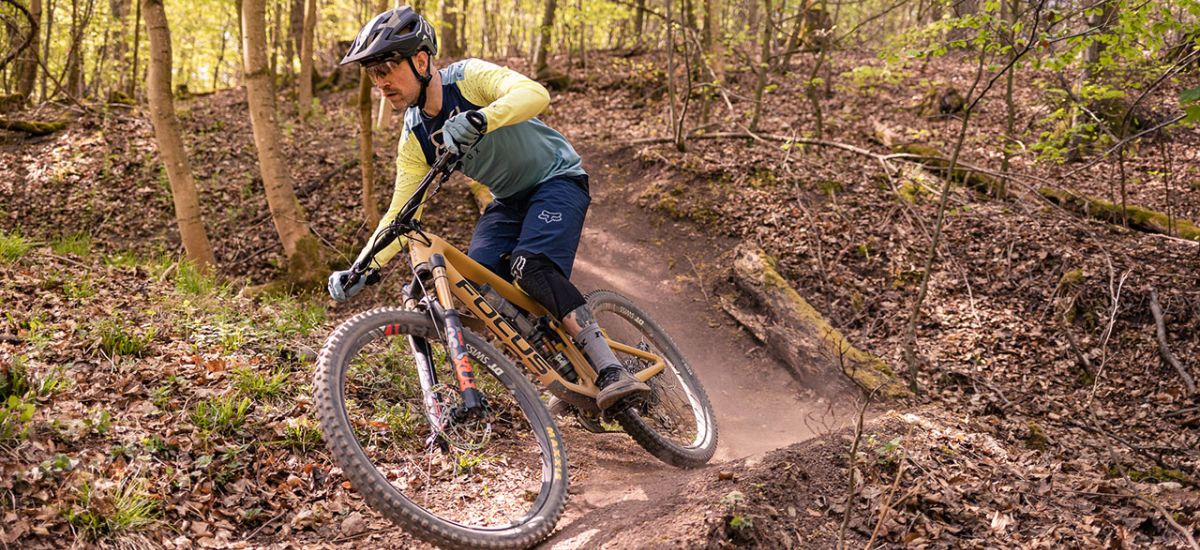
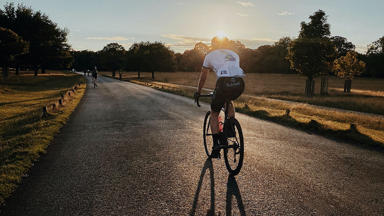
Mountain bike, road bike & e-bike
Oberstdorf is a true Eldorado for cyclists. Whether with mountain bike, road bike or e-bike, everyone will find their perfect tour around Oberstdorf.
Tour suggestions
elaborated bike tours and tour variants around Oberstdorf and its districts, including route descriptions, kilometer details, difficulty levels and altitude profile.
Mountain bike, road bike & e-bike
Oberstdorf is a true Eldorado for cyclists. Whether with mountain bike, road bike or the e-bike, around Oberstdorf everyone finds his perfect tour.
Tour suggestions
elaborated bike tours and tour variants around Oberstdorf and its districts, including route descriptions, kilometer details, difficulty levels and altitude profile.
The beautiful tour into the picturesque Trettach valley entices promising with an impressive mountain panorama and the crystal clear Christlessee lake
With the Trettachspitze always in view, this bike tour leads to the imposing head of the valley. With the more challenging route variants Traufbachtal and Dietersbachtal, the Trettach Valley offers something for every cyclist's taste.crystal clear mountain lake water
The starting point of the bike tour is at the Mühlenbrücke. From there it goes in a southerly direction along the Trettach via the Café Jägerstand to Gruben. On this section of the route, which is paved all the way to the Jägerstand café, there are no notable inclines; the road leads only slightly uphill into the valley.
Always in view: The striking Trettachspitze, which gives its name to the river and the Trettach Valley.
From Café Gruben, the route continues to Dietersberg. The tour leads sunny past the mountain inn Riefenkopf and the Mumme-Stüble before crossing the river and the road to Spielmannsau in the direction of Christlessee.
Now it is not far until the crystal clear water of the Christlessee comes into view. Here it is worthwhile to take a short break and pull out the camera.
To the alp Oberau
From Christlessee, the tour continues south until it reaches the hamlet of Spielmannsau. In addition to a mountain inn, the Landhaus Spielmannsau and the Mountain Hostel are also located here.
With this stage goal, the largest part of the route is already done. Only another 500m to go, further in a southerly direction into the Trettach valley to the Oberau alpine dairy. With a hearty snack, the energy reserves can be refilled, before on the way back and via the golf course Gebrgoibe back to Oberstdorf.
Along the Stillach river, always looking at the striking peaks of the Allgäu main ridge, the sunny Stillach valley offers an excellent destination for all cycling enthusiasts
In addition to the rather leisurely bike route to Alpe Eschbach, the Stillachtal is also an excellent starting point for longer and more challenging bike tours. Whether you want to go to Einödsbach, the southernmost settlement in Germany, to the Rappenalp valley or up to the Schlappold alpine pasture, here you will find detailed descriptions of the bike tours including mileage and altitude profiles.
Numerous highlights along the route
At the Loretto chapels begins the rather leisurely bike tour in the direction of Stillachtal. Following the Lorettostraße to the south, the Renksteg and with it the Nordic Center Oberstdorf soon comes into view. Here, in winter, cross-country skiers and trial biathletes romp about on the cross-country trails having fun together.
The route continues along the Stillach dam in the cool shade of the river until the first major highlight of the route is reached: the Oberstdorf ski jump.
If you have some time with you, you should definitely take a break here and visit the completely modernized ski jump.
In Richtung Fellhornbahn
Past the ski jump area, following the footpath and cycle path, the route continues into the valley to the Fellhornbahn valley station. From here on, the road is closed to public traffic, which is also the reason why the next section of the route can run on the paved alpine road. Nevertheless, you still have to watch out for passing public buses.
About 10 minutes after the Fellhornbahn, the hamlet of Birgsau comes into view on the left side. The houses with the small chapel lie picturesquely against the fantastic backdrop of the Allgäu Alps. The Birgsauer Hof restaurant invites you to stop here for a bite to eat. However, if you prefer something simpler and more rustic, you can cycle a little further into the valley to Alpe Eschbach. The alpine pasture is managed in summer and produces its own cheese, which can be tasted during a hearty snack.
Hardly any valley can be compared to the Oytal in terms of versatility. The landscape is characterized by sharp rock faces where waterfalls roar into the valley, gentle mountain meadows where herds of cattle graze in spring and autumn, and above it all, the majestic peaks of the Oberstdorf mountains.
Via the Dr.-Hohenadl-weg, you can cycle into the wild and romantic Oytal to the Oytalhaus or even further, past the Stuibenfall, up to the Käseralpe.
Over the Dr. Hohenadlweg
From the mill bridge, the trail leads along the Trettach River in the shade to the Cafe Jägerstand.
At the junction Oytal - Gruben, the foot and cycle path follows the Dr. Hohenadl-Weg along the Oybach into the Oytal.
After about 1.7 km the gravel path meets a tarred alpine road, which is also used by shepherds and hunters. Now the sunny stretches become more frequent and longer.
Stop at the Oytalhaus
Passing lush mountain meadows and through an idyllic sycamore maple avenue before reaching the mountain inn Oytalhaus. With its large terrace and other child-friendly facilities, the Oytalhaus is an ideal destination for families. The view of the steep field walls to the right of the Oytalhaus is also particularly spectacular here. Here, the water of the Seealpsee outlet tumbles over the so-called lake walls.
On the way back, you can choose the road over the Kühberg. Pure sun and a beautiful view of Oberstdorf can be enjoyed here on nice days.
This easy bike tour leads across sunny meadows and through shady forests to the romantically situated villages of Oberstdorf.
For exploring the Oberstdorf districts of Rubi and Reichenbach, hardly anything is better suited than the bicycle. The charm of the idyllic villages can be experienced on the easy, beautifully situated cycling and hiking trails. Especially families get their money's worth here. Those who want something more sporty can try the tour variant Gaisalpe, where it goes up to about 1,126 m.More details and more detailed information about the bike tours can be found here.
Through sunny meadows
Start by bike at the Dummelsmoosbrücke, on the eastern outskirts of Oberstdorf. From there, a sunny meadow path, which is equally popular with cyclists and pedestrians, leads via Rubi to Reichenbach.
With their old farmhouses and village charm, the districts of Rubi and Reichenbach are always worth a visit.
The bike tour continues over the Moorbad to the west of Reichenbach, through fields and flower meadows, up to the Schöllanger Burgkirche. On this section of the route, the ascent is somewhat steeper, before the gravel descent takes you downhill again and on to Fischen Au.
To Illerursprung
From Fischen Au the route runs on a shady gravel path, along the Iller dam, back towards Oberstdorf. After about 4.5 km, the birthplace of the Iller is reached: the Illerursprung. Here the rivers Trettach, Stillach and Breitach flow together to form the Iller.
Nun ist es nur noch ein kurzes Stück Weg bis über den Illersteg der Ausgangsort Oberstdorf wieder in Sicht kommt.
Numerous highlights entice you on this bike tour in the well-known tiefenbach side valley. In addition to the old wooden chapel of St. Anna, a European watershed and the deepest gorge in Central Europe, cyclists are offered magnificent views of the valley.
From Tiefenbach, this popular bike tour leads into the Rohrmoostal valley via the Osterbergalpe and the Engenkopf. With the Piesenalpe variant listed below, the route runs picturesquely situated up to the well-known Sennalpe.
A real classic
is the bike tour to the Rohrmoostal.
From the northern exit of Oberstdorf, the route runs on a small bike path parallel to the federal road B 19 to the Breitach bridge. At the bridge, the bike and sidewalk path leads to the left in the direction of Tiefenbach. The road now follows the bed of the Breitach stream before the route turns right after about 2.5 km into Tiefenbach. Arrived in Tiefenbach village center, the bike tour turns left after the tourist information Alpenrose, in the direction of Rohrmoostal. From here it goes uphill. Soon you will reach the barrier where motorists have to pay a toll to continue to Rohrmoos. For cyclists, the tarred road runs free of charge and steadily ascends further into the valley. Just under 200 meters in altitude are covered on the route from Tiefenbach to Gasthof Rohrmoos.
Past ancient chapels and deep ravines
In the hamlet of Rohrmoos, you can take a short break and visit the beautiful frescoes of the old wooden chapel of St. Anna. From here it is also only a few minutes drive to the European watershed (Rhine/Danube).
Back it goes south of the Starzlach for about 6 kilometers in the direction of Osterbergalpe. The ascent to 1,263 m is steeply uphill. Therefore, here and on the later descent from the Dornach Alpe to Tiefenbach, an appropriate level of riding skill is necessary.
From the managed Osterbergalpe, the route goes around the Engenkopf, via the Alpe Dornach, to the entrance of the Breitachklamm gorge. On this section of the route, cyclists will repeatedly enjoy magnificent views of the neighboring Kleinwalsertal valley.
Via Tiefenbach the bike tour finally leads back to the starting point, Oberstdorf.
n the shadow of the Besler massif and past idyllic alpine huts: When cycling in the quietly situated Lochbach valley, you can experience a still almost untouched nature.
From Tiefenbach, the quietly situated bike route runs through the high valley Lochbachtal and over various alpine huts to Rohrmoos.
The starting point of this tour is the Alpenrose in Tiefenbach. From here, head in a northerly direction along the Lochbachstraße. After about 1.5 km you will find the turnoff to the Lochbach valley on the left. A tarred alpine road leads steeply uphill here in numerous hairpin bends. Passing the Lochbach and Schwaben alpine pastures, the route now continues slightly uphill into the valley. The high valley is framed here by high, narrow grassy slopes on which herds of cattle often graze.
After passing more alpine huts, soon comes the Dinjörgen Alpe in sight. Refreshing drinks and delicious snacks invite you to take a short break.
If you let your gaze wander, you will be offered an impressive view of the striking rock massif of the high Ifens.
Who loves his bike, ...
Continue on the alpine road for about 600 meters to the Toniskopfalpe, which is not open for business. For e-bike riders, the Lochbachtal round ends here. Mountain bikers have the option of descending on a narrow path to Rohrmoos. On this section of the route, the bikes have to be pushed downhill and possibly even carried a few meters. Numerous roots, stones and gradients make safe cycling impossible.
From Gasthof Rohrmoos it goes another 15 kilometers over the Osterbergalpe and around the Engenkopf, back over the Alpe Dornach to Tiefenbach
In a constant up and down, the dreamlike route leads into the beautifully situated Kleinwalsertal, past alpine huts, up to the area of the mountain railroads.
From the Osterbergalpe, this 35 km long bike tour takes you into the neighboring Kleinwalsertal and up to the Söllereck.
Att the Söllereck
The starting point of this round is the Osterbergalpe. (Details and more detailed information about the route to the Osterbergalpe, you can find: here).
At the crossroads, the trail turns left into the high moor "Unterhörnnle". This trail now continues to the left to the Hörnlepasshütte at the Klausenwald.
When this part of the route is done, you now cross the Breitach bridge, and after another 500 meters turn left along it. Shortly after the small village of Unterwestegg, the asphalt road climbs to the right, via Schwand to the Bergstüble and the Mittelalpe. From there, follow the old church path in the direction of Amannsalpe. On this partly very steep section you have to pedal hard to get ahead. However, once you have reached the top of the Söllereck, you can enjoy a magnificent view. The Söllereck is a 1706 m high mountain in the Allgäu Alps near Oberstdorf. With the neighboring mountains it divides the Stillachtal from the Kleinwalsertal.
Fantastic view of Oberstdorf
Now the trail goes steeply downhill from Schönblick, past the Söllereckbahn valley station to Kornau. Caution is advised when crossing the B19 federal road, which must be crossed before reaching the small village of Kornau. From the village center, the route continues to Reute. Here, breathtaking panoramic views of Oberstdorf are offered. At the height of the Oberstdorf Hotel, the foot and bike path continues over the Waldesruhe and the Schlechtenbrücke back to the center of Oberstdorf.
Sunny, this bike route leads through the most beautifully situated villages in southern Oberallgäu along the peaks of the Hörnergruppe. Via the idyllic villages of Obermaiselstein, Bolsterlang, and Ofterschwang, the route leads to Sonthofen through the Hörner villages.
Att the Hirschsprung
From the Alpenrose in Tiefenbach (route details to Tiefenbach can be found here), the route continues to Obermaiselstein. On this part of the route you will pass a rocky mountain, the Hirschsprung. Legend has it that a deer fleeing from a lynx managed to jump from one edge of the cliff to the other. A small sign keeps the story in memory.
Along the horns group
From Obermaiselstein, follow the road in the direction of Fischen until you reach the Bolsterlang turnoff. There follows a climb of about 1.5 km to the community of Bolsterlang. Here the well-known Oberallgäu golf course is on the route. The 18 +9 -hole course has something to offer for everyone from beginners to professionals. Via the communities of Ober- and Untermühlegg, the course runs past the villages of Dietrichs and Muderbolz to Ofterschwang. From Ofterschwang, which is known for its ski world cups in winter, the tour runs through Hüttenberg to Lake Sonthofen. The beautifully situated body of water invites you to linger and swim. Back to Oberstdorf it goes along the Iller dam.
On the way in sunny valleys and in the shade of mighty mountain flanks this fantastically situated bicycle tour runs beyond the German border. Through the picturesque Rohrmoostal, this challenging bike tour leads into the Bregenzerwald, to the Austrian community *Sibratsgfäll*.
Across the border
From Rohrmoostal, a slightly ascending alpine road leads further to Sibratsgfäll. On the way to Sibratsgfäll you should make a small stop. Approximately 2 km after the hamlet of Rohrmoos there is a European watershed. There the water flows either via Starzlach, Breitach, Iller, Danube into the Black Sea or via Schönbach, Bolgenach, Lake Constance, Rhine into the North Sea.
About 3 km before Sibratsgfäll the Austrian border is passed.
Im Lochbachtal
Via the road to Balderschwang you will reach the parking lot Scheuen and the alp Dinjörgen in the Lochbach valley. From the Austrian municipality of Sibratsgfäll it is about 21 km to here. Once in the Lochbachtal, a paved alpine road leads curvaceously downhill. At first, the route is only slightly downhill past the various alpine huts before the road winds more steeply to the lower Tiefenbach. From there it is a slight downhill back to Oberstdorf. About 13 kilometers lie between the Alpe Dinjörgen in the Lochbachtal and the finish point Oberstdorf.
Via the Oberstdorf districts to Hindelang and even further deep into neighboring Hinterstein, this bike route leads to the Giebelhaus.
About Rubi, Reichenbach and Schöllang
Via the Oberstdorf districts of Rubi and Reichenbach, this bike tour continues in the direction of Schöllang. From Schöllang the bike tour goes via the villages Hinang, Altstädten, Beilenberg, Hofen, Margarethen and Binswang to Hindelang. About 12.5 km are covered on this section of the route.
From Hindelang, the bike tour continues into the picturesque Ostrachtal valley to Hinterstein. For a little refreshment on the way, the "Prinze-Gumpe" is an excellent place to rest. The Kneipp spa garden in Hinterstein is one of the most beautiful mountain spas in the entire Allgäu. Continue on a closed valley road, into the Hinterstein valley. After about 10 km you will reach your destination, the Giebelhaus. Located in the middle of the nature reserve of the Allgäu High Alps, the inn invites you to stop for a break.
Back via Sonthofen
On the way back, the route takes you along the shady Ostrach dam to Sonthofen. A good 22 km are covered on this section of the tour until the town of Sonthofen is reached.
From there, the bike course runs along the Iller River back to Oberstdorf.
The almost 53 kilometer long route of this bike tour leads past idyllic alpine villages, the cool waters of the large alpine lake and along in the shadow of the Iler dam.
Through sunny villages
leads the first stage of this bike tour. It starts in Oberstdorf via the villages of Tiefenbach, Obermaiselstein, Bolsterlang to Hüttenberg (a more detailed description of this section of the route can be found here). Between the villages of Tiefenbach and Obermaiselstein lies the Hirschsprung. According to legend, in earlier times a deer jumped over the rocky ridge here in flight from a lynx. Today, a small sign reminds of the story of that time.
Starting from the small village of Hüttenberg, the tour goes through Bihlerdorf, about 2.5 km away, and along the shady Iller dam. Arriving in the town of Immenstadt, the route leads to the largest natural lake in the Allgäu: the Großer Alpsee. Right next to it is the Small Alpsee.
Water fun is written in capital letters here!
Past the cool water
After cooling off, the return trip takes you along the Iller dam back to Oberstdorf via the source of the Iller. In total, this bike tour covers about 53 kilometers. Therefore, a good condition is a prerequisite for riding this route.
Guided e-bike tours by Tourismus Oberstdorf with mountain bike guide to the Piesenalpe, into the Rappenalptal and over the Dörfle and the Illerdamm can be found in the activity program.